On January 9, 2024, at 21:45:55.0 UTC, an object entered vertically to the atmosphere and produced a fireball over the North East of France
Introduction
On the night of Tuesday January 9, at about 22h45m CEST, a fireball has been observed from a vast region including the BeNeLux. On the IMO website, 81 people, mainly from Belgium, the Netherlands and Germany, reported to having seen a meteor for a few seconds with a brightness equivalent to the Full Moon.
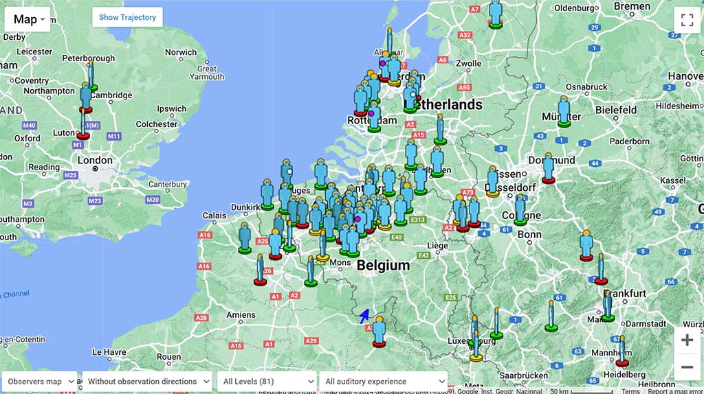
Figure 1 – Map of 81 eyewitnesses on 198-202 event IMO page
Five All-sky cameras from the Fripon network recorded the event and their calculations motivated their team to spend a day searching for a meteorite. Cameras from the Global Meteor Network and the CAMS network, with smaller fields of view, also recorded the fireball.
Observations
The sky was cloudy over the north-eastern quarter of France, preventing french cameras to record the fireball.
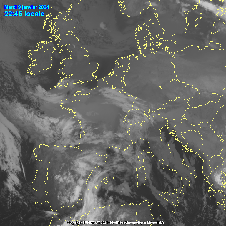
Figure 2 – Infrared satellite weather image 2024/01/09 21:45 UTC (courtesy : EUMETSAT/meteociel.fr)
Four stations part of Global Meteor Network and CAMS BeNeLux have captured the event : BE000P and BE0003 from Belgium, DE0005 from Germany and NL0001 from Netherland.
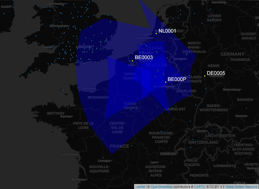
Figure 3 – Cameras field of view at 100 km of height (courtesy : GMN/ tammojan)
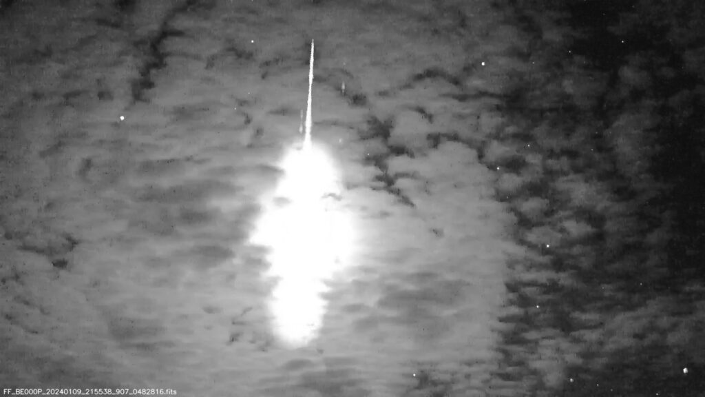
Figure 4 – The fireball as recorded from BE000P (courtesy : Paul Roggemans)
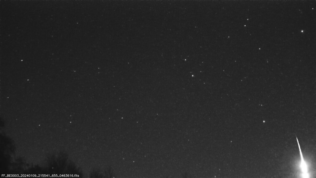
Figure 5 – The fireball as recorded from BE0003 (courtesy : Steve Rau)
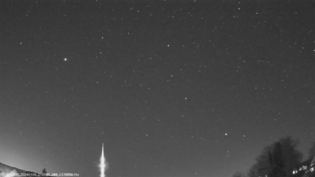
Figure 6 – The fireball as recorded from DE0005 (courtesy : Jurgen Dörr)
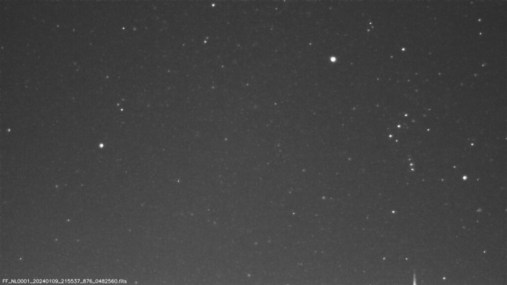
Figure 7 – The fireball as recorded from NL0001 (courtesy : Kees Meteor)
Fireball analysis
All these cameras work with an RPi Meteor Station. The night’s video files are stored in a “Captured” folder as compressed images FF*.fits in 10-second image sequences. Then they are analyzed, at the end of the night, the astrometry is carried out, and the meteor captures are duplicated in an “Archived” folder. In the case of a bright event, the program stores a raw image sequence of the object in the “Captured” folder as FR*.bin file.
As explained in the video guide by Denis Vida and Mark McIntyre’s guide “Advanced Meteor Analysis”, ”, I analyzed each four captures by a manual reduction with the software SkyFit2 and after a multi-station triangulation analysis, the trajectory was derived using the WMPL (WesternMeteorPyLib) trajectory solver.
I used the uncompressed FR*.bin video files, which are better suited for manual reduction, for the first part of the trajectory on BE000P, for the capture on BE0003 and for the second part on DE0005. Compressed FF*.fits video files were used for the second part of the trajectory on BE000P (called BE000P_2) and for the low-light fireball video capture on NL0001.
WMPL solved the trajectory with an option of 20 good simulations. The spatial residuals better than 200 meters and a smooth curve of the state vector show a good correlation between the different sets of reduced data.
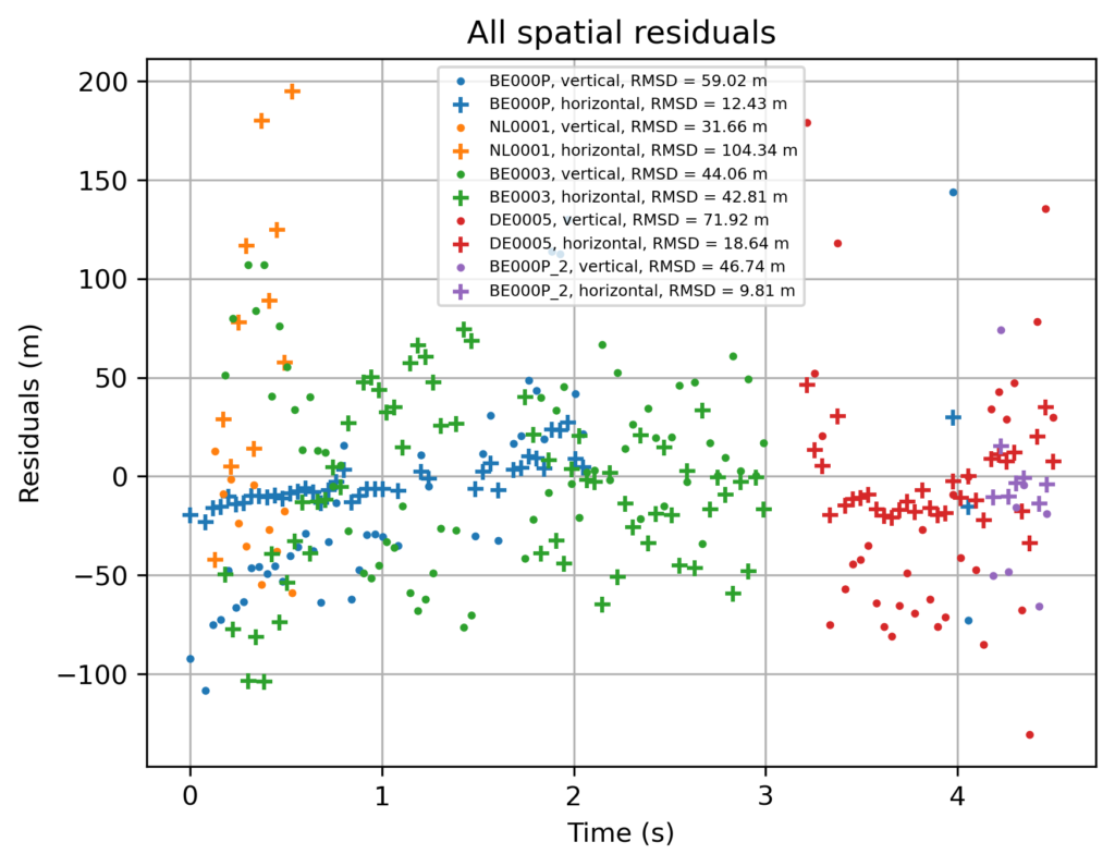
Figure 8 – Horizontal and vertical spatial residuals for all captures in function of time.
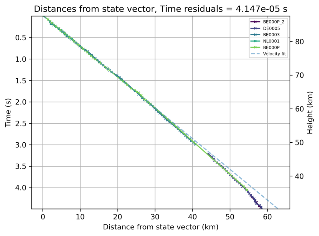
Figure 9 – Distances from the state vector.
Trajectory result
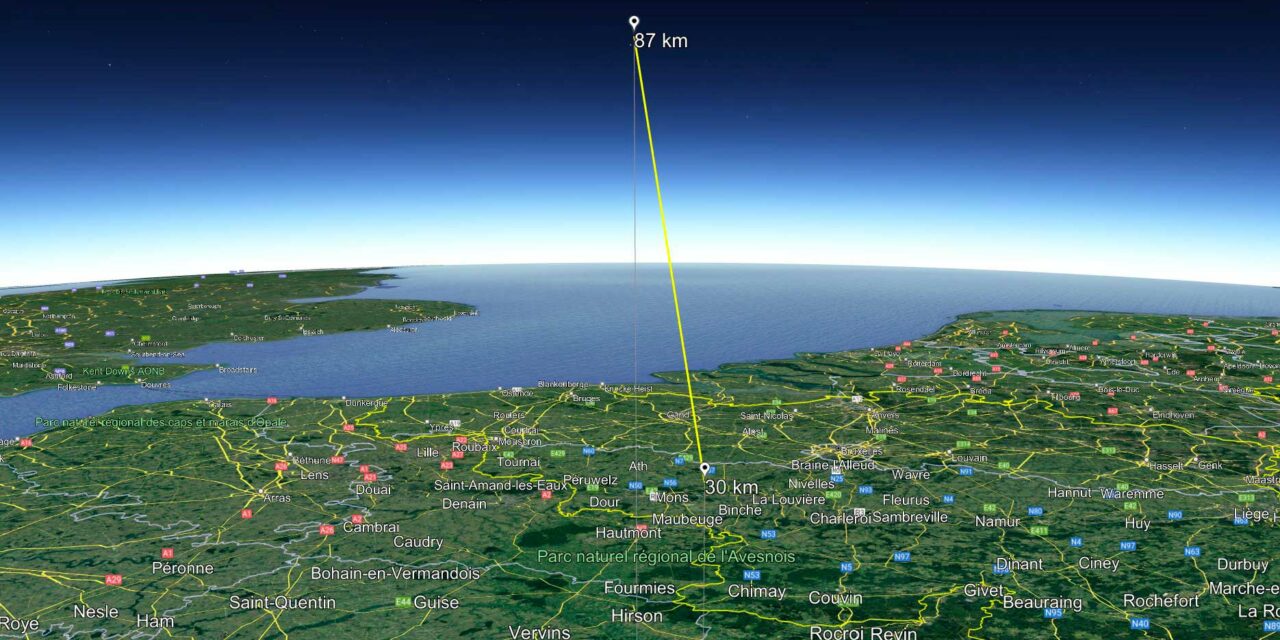
At 21h45m55s UTC, on January 9th, 2024, the object penetrated into the atmosphere with an almost vertical trajectory, an entrance angle of 81° and a low velocity of 14 km/s. The luminous path started at an elevation of about 87 km and ended at 30 km, with a total duration of 4.5 seconds. The trajectory parameters indicate good chances for the survival of the object through the atmosphere and a short strewn field if any meteorites got dropped.
Unfortunately, the manual reduction could not give a good indication of the magnitude of the fireball and therefore it’s difficult to estimate the size of the object.
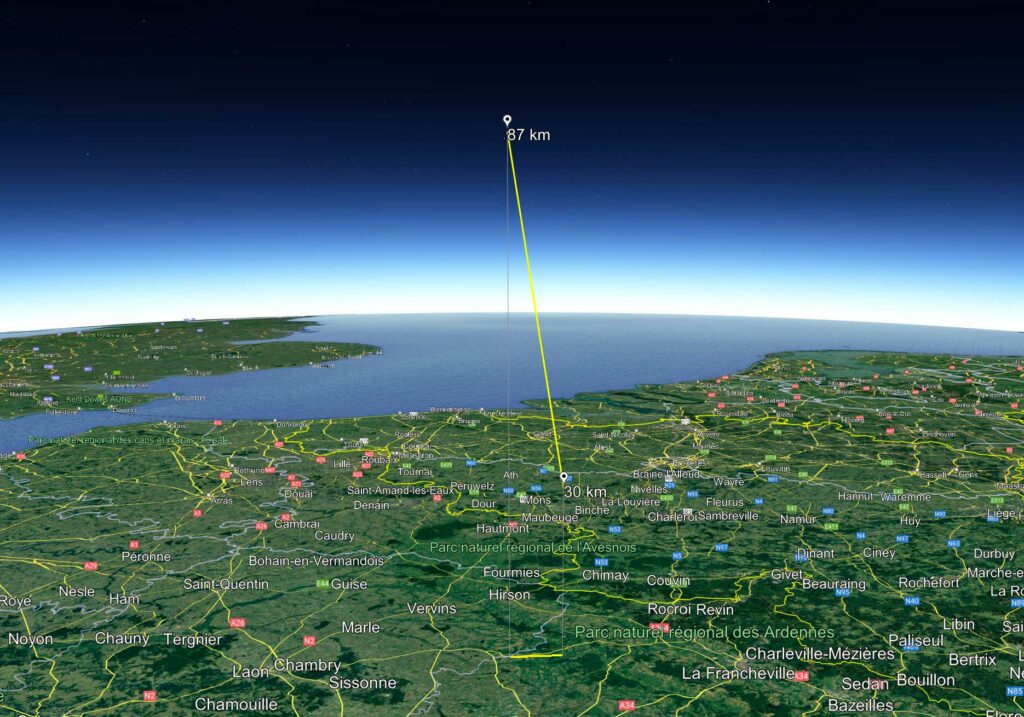
Figure 10 – 3D view of the trajectory
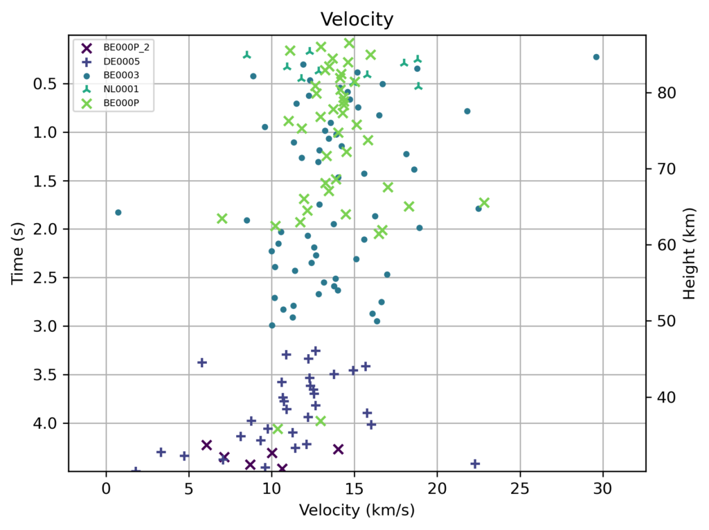
Figure 11 – Velocity as calculated by WMPL
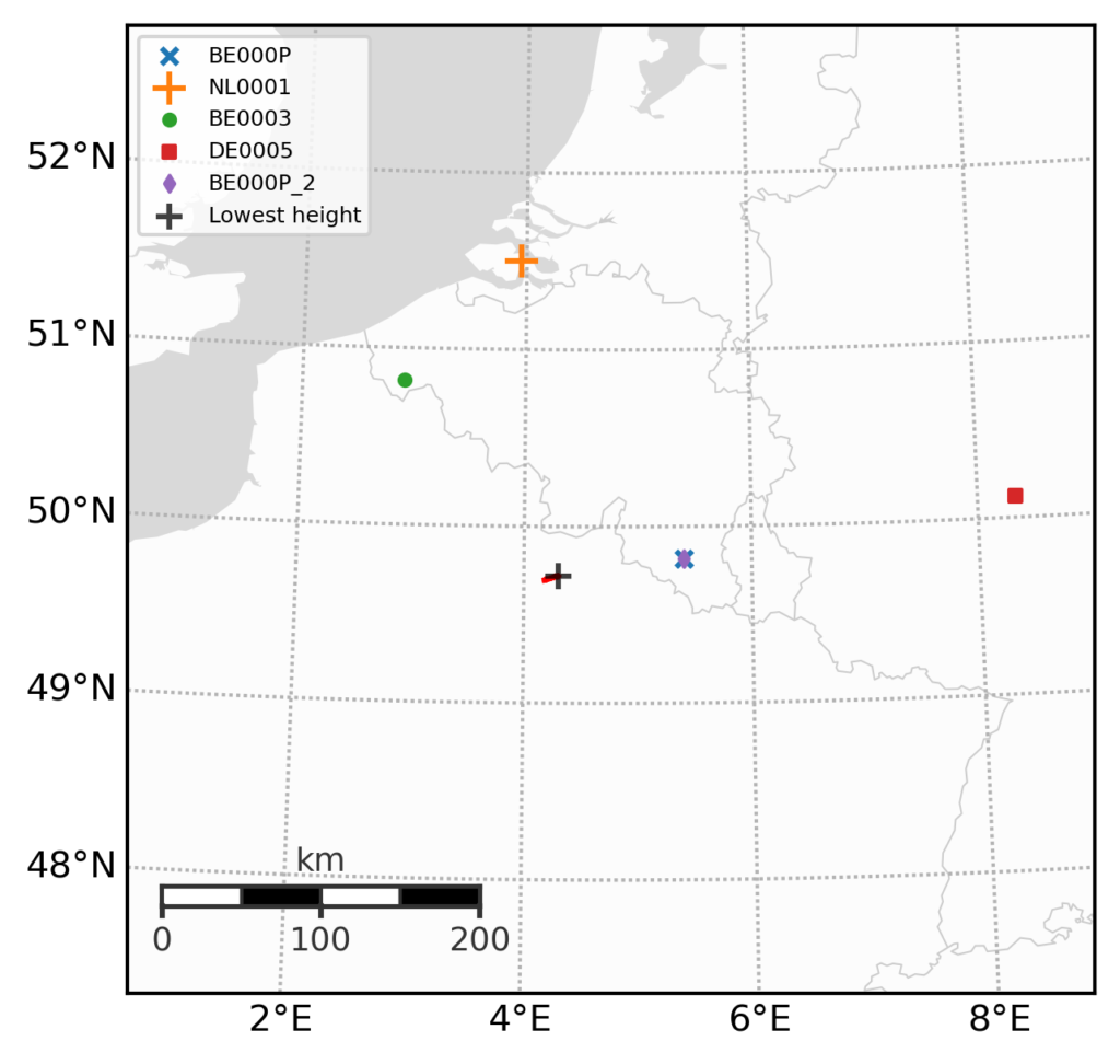
Figure 12 – ground track
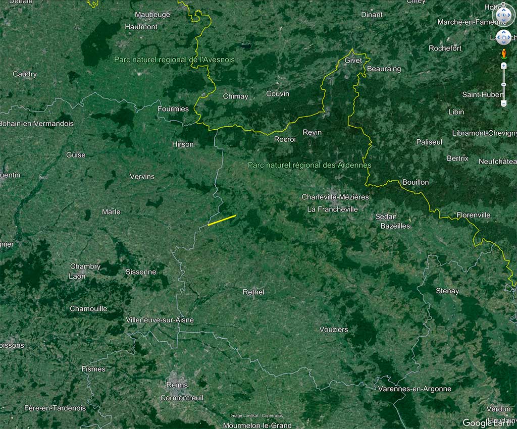
Figure 13 – Ground path of the trajectory on Google Earth map.
Table 1 – The orbital elements of the fireball of 9 January 2024 at 21h45m55.0s UT as obtained with WMPL computation.
| ± | 95% CI | |||
| αg | 64.05 | 0.08 | [63.92, 64.17] | ° |
| δg | 44.86 | 0.02 | [+44.87, +44.96] | ° |
| Hb | 87.55 | 0,03 | [87.49, 87.58] | km |
| λb | 4.1814 | 0.0004 | [4.1809, 4.1821] | °E |
| φb | 49.6957 | 0.0001 | [49.6958, 49.6962] | °N |
| He | 30.14 | 0.004 | [30,14, 30,15] | km |
| λe | 4.301 | 0.0005 | [4.300, 4.302] | °E |
| φe | 49.7203 | 0.0001 | [49.7201, 49.7204] | °N |
| vꝏ | 13.96 | 0.005 | [13.94, 13.96] | km/s |
| vg | 8.45 | 0.008 | [8.42, 8.45] | km/s |
| a | 1.70 | 0.002 | [1.69, 1.70] | AU |
| q | 0.9379 | 0.0001 | [0.9378, 0.9382] | AU |
| e | 0.447 | 0.0006 | [0.445, 0.447] | – |
| ω | 211.78 | 0.05 | [211.69, 211.86] | ° |
| Ω | 288.78 | 0.00002 | [288.78, 288.78] | ° |
| i | 5.41 | 0.005 | [5.40, 5.42] | ° |
| Tj | 4.08 | 0.003 | [4.08, 4.09] |
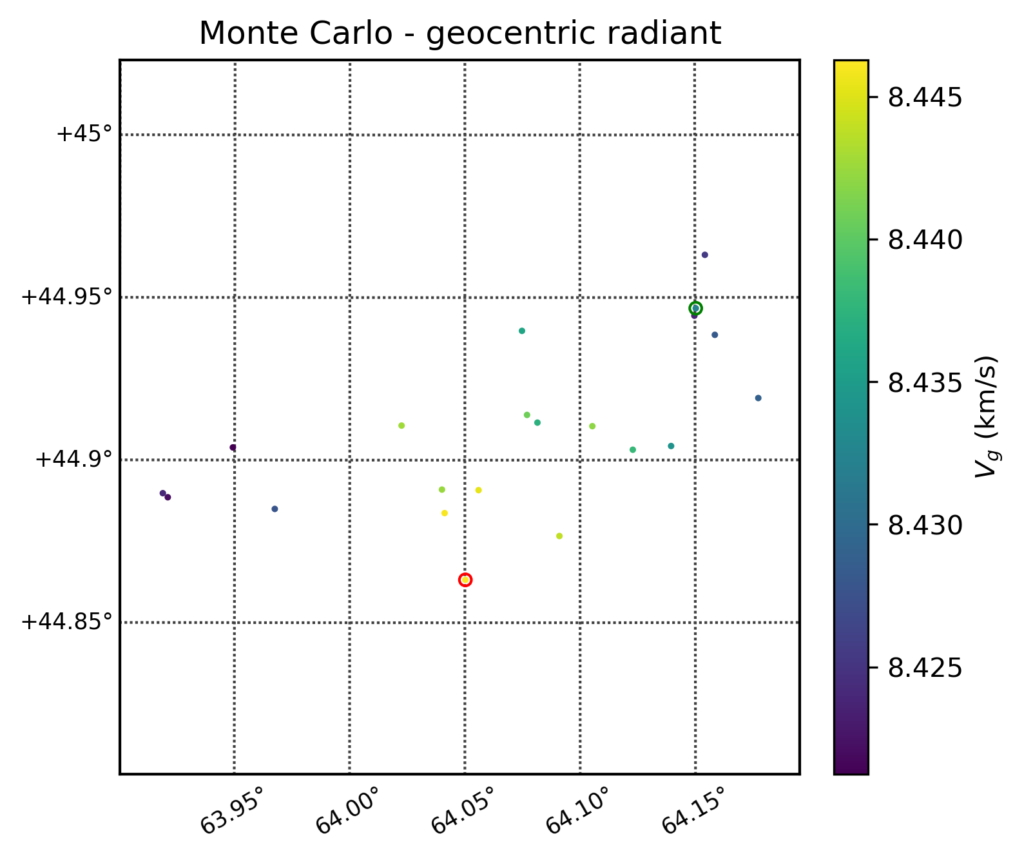
Figure 14 – Monte Carlo geocentric radiant
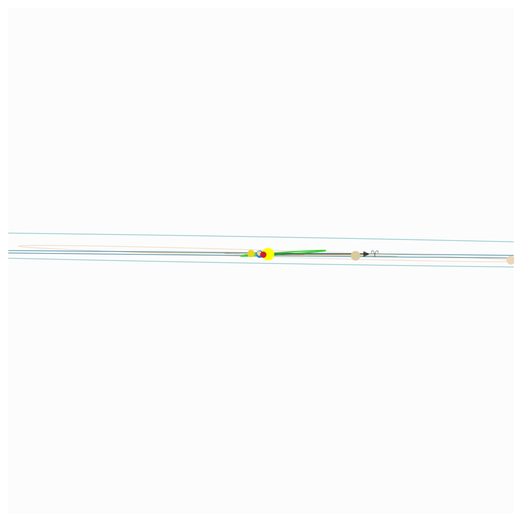
Figure 15 – Side view of the orbit of the object
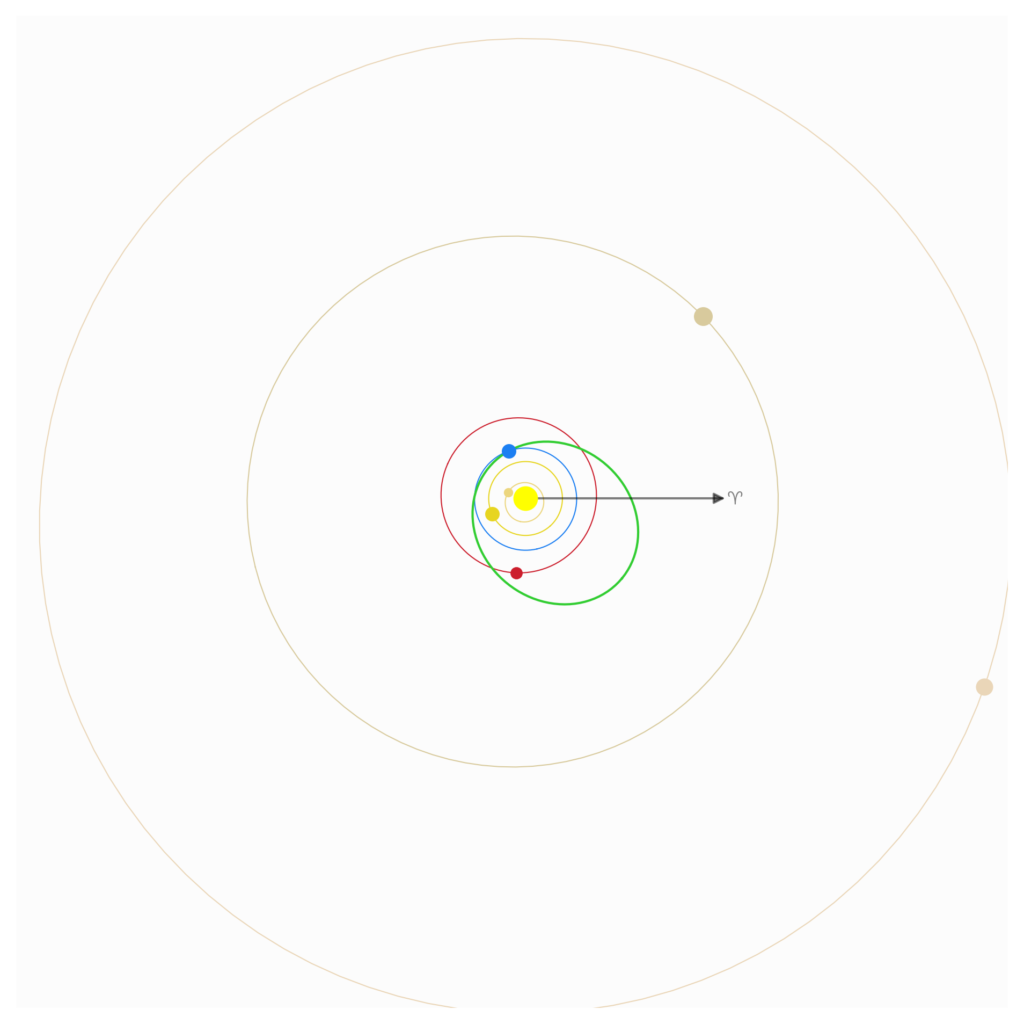
Figure 16 – Top view of the orbit of the object
Acknowledgment
This report was possible thanks to the efforts of camera owners: Jürgen Dörr, Kees Habraken, Steve Rau and Paul Roggemans who quickly checked their observations, as well as Paul’s knowledge of the camera network. And of course, to the programmers of the open source softwares RMS and WesternMeteorPyLib.


L’heure est 21h55’45” mais pas 21h45’55” qui semble être une coquille-inversion. Ces enregistrements semblent cohérents avec ce bolide mag-8à10 ,13.6 km/s durée 5s qui s’est éteint vers 26km a bien terminé sa course dans les Ardennes. Ses paramètres et trajectoire sont calculés ici :
https://fireball.fripon.org/displaymultiple.php?id=22218
Il serait utile de comparer avec vos données-calculs. Fripon VigieCiel n’a pas publié la zone de chute probable avec la répartition des masses en tenant compte des vents. Il a fait l’objet d’une annonce médiatique ici : https://www.vigie-ciel.org/2024/01/12/chute-probable-de-meteorites-dans-les-ardennes/ https://france3-regions.francetvinfo.fr/grand-est/ardennes/une-meteorite-s-ecrase-en-france-2905514.html